
- Enseignant: HADJ HABIB HOUARI

Mapping and cartography is the study and practice of making maps, combining the art of design with the science of representing spatial data. Historically, maps were hand-drawn tools for navigation and conveying information, but modern cartography uses digital technologies like GIS, satellite imagery, and aerial photography to create dynamic, data-rich maps. These modern maps go beyond simple locations to analyze complex data for applications like urban planning and tracking disease outbreaks. 
- Enseignant: Dr. Sid Ahmed AOUADJ
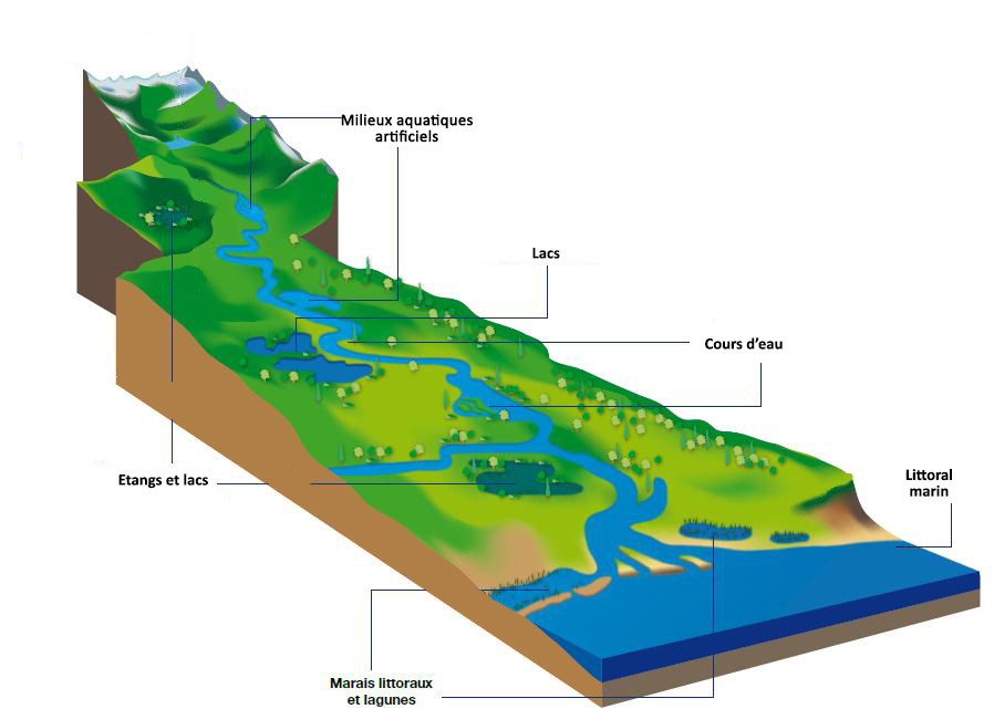
Ce cours est destiné aux étudiants en cycle de Master de spécialité Ecologie. Il vise les objectifs globaux suivants:
- Comprendre les délimitations et les types des milieux aquatiques.
- Comprendre le fonctionnement des écosystèmes lacustres.
- Découvrir les milieux marins et littoraux et leurs fonctionnements.
- Découvrir la biodiversité des milieux aquatiques.
- Enseignant: Mohammed El Amine BENTAALLAH